Umatilla
This is your travel guide for Umatilla, Oregon, United States
1 : Visit Umatilla Marina & Park [2 hrs]
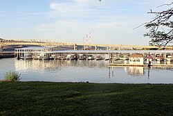
Enjoy a relaxing walk along the Columbia River, take in the scenic views, and have a picnic in this beautiful park. You can also rent a boat or kayak to explore the river or try your luck at fishing off the marina docks.
2 : Explore McNary Dam [1 hr]
Learn about the history and functions of the McNary Dam, which provides hydroelectric power and navigation for the Columbia River. Enjoy the views of the dam and watch salmon and steelhead fish swim upstream at the fish viewing windows.
3 : Taste local wines at Echo Ridge Cellars [1 hr]
Indulge in a wine tasting experience at Echo Ridge Cellars, a boutique winery known for its handcrafted wines. Learn about the winemaking process, stroll through the vineyards, and savor the flavors of their award-winning wines.
4 : Visit Hat Rock State Park [2 hrs]
Hike through the scenic trails of Hat Rock State Park, named after a distinct rock formation that resembles a pioneer hat. Enjoy birdwatching, picnicking, and stunning views of the Columbia River Gorge from the top of the rock.
Background Info
Weather
Umatilla experiences a dry, semi-arid climate with hot summers and cold winters. Summer temperatures can reach the mid 80s to low 90s Fahrenheit (around 27-34°C), while winter temperatures can drop to the mid 20s to low 30s Fahrenheit (around -4 to 1°C). Rainfall is limited, and humidity levels are generally low.
Language
English
Cost Of Living
The cost of living in Umatilla, Oregon, is lower than the national average. Housing costs are affordable, and utilities, groceries, and transportation expenses are reasonable. Overall, Umatilla offers a cost-effective living environment compared to many other parts of the United States.
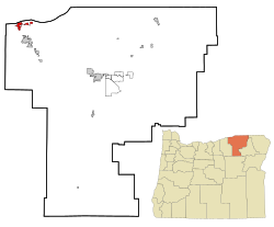
Umatilla – city in Umatilla County, Oregon, United States
Location: Umatilla, Hermiston, Oregon 97882, United States of America![]()
Official Site: Visit Official Site
Summary: Umatilla Summary
Map: Map of Umatilla
Weather: Umatilla Forecast
Post Codes: 97882
Dialing Codes: 541
Population: 6,906 (2010)
Elevation: 98 m
Area: 12.02 sq km
Coordinates: 45.917, -119.343
Timezone: (UTC-08:00) Pacific Time (Los Angeles)


