Newberry Springs-Baker
This is your travel guide for Newberry Springs-Baker
1 : Visit the Route 66 Sign [<1 hr]
Start your journey by visiting the iconic Route 66 Sign in Newberry Springs, a must-see photo opportunity for all fans of the historic highway.
2 : Explore the Bagdad Cafe [<2 hrs]
Head to the famous Bagdad Cafe, known for its appearance in the 1987 film of the same name. Enjoy a meal or just soak in the quirky atmosphere of this unique roadside stop.
3 : Discover the historic Ludlow Cafe and Gas Station [<1 hr]
Stop by the Ludlow Cafe and Gas Station, a relic from the early days of Route 66, offering a glimpse into the past with its vintage gas pumps and classic diner setting.
4 : Take a break at the Bottle Tree Ranch [<1 hr]
Marvel at the fascinating Bottle Tree Ranch, an art installation featuring hundreds of colorful glass bottles arranged in whimsical designs, creating a mesmerizing roadside attraction.
5 : Visit the Mojave Desert Preserve [<3 hrs]
Explore the beauty of the Mojave Desert Preserve, showcasing the unique flora and fauna of the desert ecosystem, with stunning vistas and hiking opportunities for nature enthusiasts.
Background Info
Weather
Newberry Springs-Baker experiences hot summers with temperatures often exceeding 100°F (37.7°C) and mild winters with temperatures around 60°F (15.6°C). Rainfall is low with little precipitation throughout the year, and humidity levels are generally low. Air quality can be affected by desert dust particles.
Language
English is the primary language spoken in the area.
Cost Of Living
The cost of living in Newberry Springs-Baker is lower than the national average, with affordable housing prices and everyday expenses.
Other
Newberry Springs-Baker is a popular stop for travelers exploring the historic Route 66, offering a glimpse into the past with its well-preserved landmarks and unique attractions.
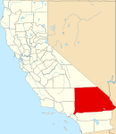
San Bernardino County – county in California, United States
Location: Newberry Springs-Baker, California 92365, United States of America![]()
Official Site: Visit Official Site
Summary: San Bernardino County Summary
Map: Map of San Bernardino County
Weather: San Bernardino County Forecast
Local Names: San Bernardino County (English)
Population: 2,035,210 (2010)
Area: 52,073 sq km
Coordinates: 34.83, -116.19
Timezone: (UTC-08:00) Pacific Time (Los Angeles)


.svg.png)
