1 : Visit Burnt Mills East Park [1 hr]
Spend some time exploring Burnt Mills East Park, a lovely green space with walking paths, picnic areas, and a playground. Enjoy the peaceful surroundings, observe local wildlife, or have a relaxing picnic with family and friends.
2 : Explore Northwest Branch Trail [2 hrs]
Hike or bike along the Northwest Branch Trail, a scenic trail that winds through wooded areas and along the Northwest Branch of the Anacostia River. Take in the natural beauty of the area, watch for birds and other wildlife, and enjoy a peaceful outdoor adventure.
3 : Discover Burnt Mills Reservoir [1.5 hrs]
Make your way to Burnt Mills Reservoir, a picturesque spot for fishing, birdwatching, or simply relaxing by the water’s edge. Enjoy the serene views of the reservoir and surrounding forested area while unwinding in nature.
4 : Visit Burnt Mills West Park [1 hr]
Explore Burnt Mills West Park, another green space in the area offering walking trails, open fields, and a playground. Enjoy a leisurely stroll, play some sports, or have a quiet moment in nature.
5 : Attend the Burnt Mills Farmers Market [1.5 hrs]
Check out the Burnt Mills Farmers Market, where you can find fresh produce, local artisanal goods, and handmade crafts. Support local vendors, sample delicious treats, and immerse yourself in the vibrant community atmosphere.
Weather
The normal weather in Burnt Mills typically ranges from 30°F to 88°F throughout the year, with moderate rainfall and humidity levels. The air quality is generally good in the area.
Language
English is the predominant language spoken in Burnt Mills and the surrounding Montgomery County.
Cost Of Living
The cost of living index in Montgomery County, Maryland, is higher than the national average, mainly due to housing costs. However, the area offers a high quality of life with good schools, amenities, and access to nature.
Other
Montgomery County boasts a diverse community, excellent healthcare facilities, and a strong economy supported by industries like biotechnology, healthcare, education, and government. The county is known for its cultural attractions, outdoor recreational opportunities, and rich history.
Montgomery County – county in Maryland, United States
Location: Burnt Mills, Washington, Maryland 20901, United States of America
Official Site: Visit Official Site
Summary: Montgomery County Summary
Map: Map of Montgomery County
Weather: Montgomery County Forecast
Post Codes: 20810–20818, 20824–20825, 20827, 20830, 20832–20833, 20837–20839, 20841–20842, 20847–20855, 20857, 20859–20862, 20866, 20868, 20871–20872, 20874–20880, 20882–20886, 20889, 20891–20892, 20894–20899, 20901–20908, 20910–20916, 20918, 20993, 20997
Dialing Codes: 301, 240
Official Names: Montgomery County (English)
Local Names: Montgomery County (English)
Population: 971,777 (2010)
Elevation: 139 m
Area: 1,313 sq km
Coordinates: 39.136, -77.204
Timezone: (UTC-05:00) Eastern Time (New York)
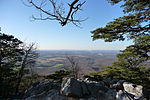
Sugarloaf Mountain MD view
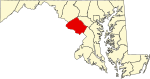
Map of Maryland highlighting Montgomery County
Flag of Montgomery County, Maryland
Coat of arms of Montgomery County, Maryland