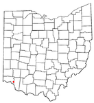
Mount Carmel
This is your travel guide for Mount Carmel, Cincinnati, Ohio
1 : Visit Kroger Hills State Nature Preserve [2 hrs]
Explore the beautiful natural surroundings, including hiking trails, wildflowers, and diverse wildlife. Enjoy a peaceful escape from the city and take in scenic views of the Ohio River Valley.
2 : Spend time at Mount Carmel Brewery [1 hr]
Taste a variety of craft beers in a cozy atmosphere. Learn about the brewing process and enjoy some local favorites in the taproom or outdoor beer garden.
3 : Discover the Cincinnati Nature Center at Rowe Woods [3 hrs]
Immerse yourself in nature with over 20 miles of trails, gardens, and wildlife exhibits. Learn about conservation efforts and enjoy interactive programs for all ages.
4 : Hike at the Mount Carmel Veterans Park [2 hrs]
Pay tribute to veterans while exploring the park’s trails and peaceful surroundings. Take a moment of reflection at the memorials and enjoy the serene atmosphere.
5 : Shop and dine at Anderson Towne Center [2 hrs]
Browse a variety of shops and boutiques, and enjoy a meal at one of the local restaurants. Take a leisurely stroll through the center and experience the community vibe.
Background Info
Weather
Mount Carmel experiences a temperate climate with warm summers and cold winters. Average summer temperatures range from 70-85°F (21-29°C), while winter temperatures can drop to 20-35°F (-6 to 2°C). Rainfall is spread throughout the year. Humidity levels can vary, especially in the summer months. Air quality is generally good in the area.
Language
English is the predominant language spoken in Cincinnati, including the Mount Carmel area.
Cost Of Living
The cost of living in Cincinnati, Ohio, is slightly below the national average. Housing costs are generally affordable, and other expenses like transportation and healthcare are also reasonable. The overall cost of living index is around 85.
Dry Run – census-designated place in Hamilton County, Ohio
Location: Mount Carmel, Cincinnati, Ohio 45244, United States of America![]()
Summary: Dry Run Summary
Map: Map of Dry Run
Weather: Dry Run Forecast
Population: 7,281 (2010)
Elevation: 266 m
Area: 12.123 sq km
Coordinates: 39.104, -84.331
Timezone: (UTC-05:00) Eastern Time (New York)

